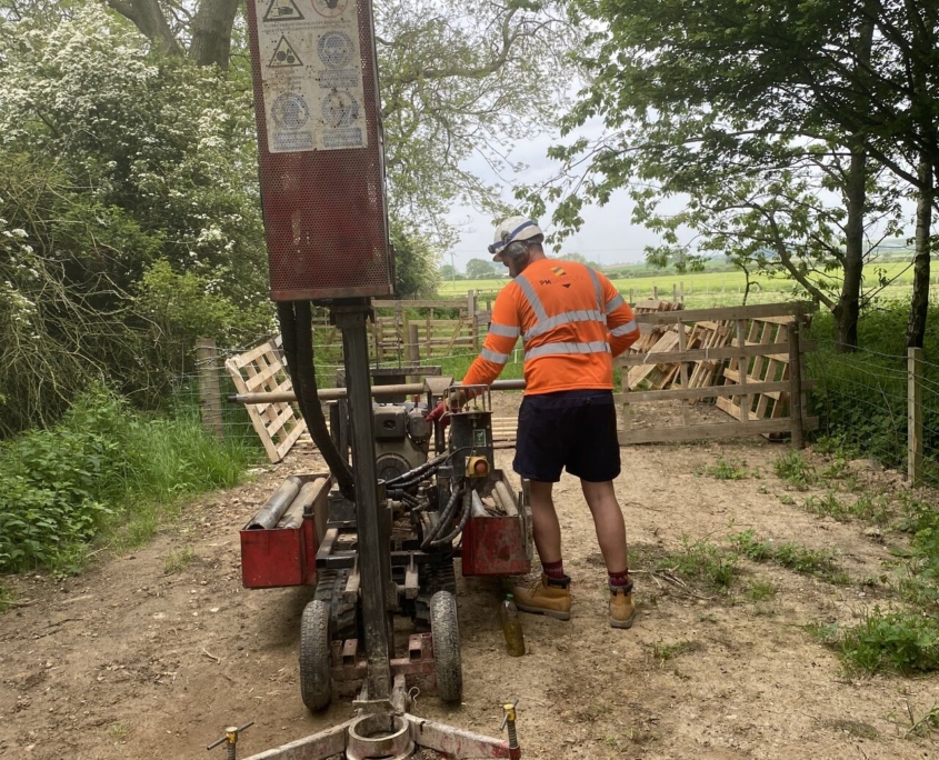
Site Investigation and Remediation Strategy
Our Services
Site Investigation Services
We undertake all aspects of site investigation services for an extensive range of clients; from initial soil analysis and feasibility/pre-purchase assessment, phase 1 desk study, flood risk assessments, contaminated land, slope stability, and basement impact to name a few….
The scope of the investigations and techniques used will depend on a range of factors including:
- The prior use of the site
- Anticipated geology and subsurface structures
- The proposed development design and function
- Known history of the site and the surroundings
- If the site is in a coal mining area
- If the site is in a flood zone
Our Site Investigation Services are an essential step in understanding your development site and ground conditions.
More Information on Site Investigation Services.
What Is the Site Investigation Process?
Site investigations are carried out with a phased approach
- Phase 1 Desk Study
- Phase 2 Intrusive Site Investigation
- Phase 3 Post Site Investigations
- Phase 4 Site Investigations Report
Step 1 – Complete the Phase I Desk Study and site walkover.
A Phase 1 Desk Study is a preliminary risk assessment report for a development site, often required for planning application approval.
Ideally, a Desk Study should also be accompanied by a walk over a survey conducted by an experienced practitioner. By compiling available information in relation to a site’s environmental, geological, hydrogeological, hydrological and mining setting, a cost-effective and focussed site investigation will be developed.
A Phase 1 Desk Study should always precede any ground investigation.Using the interpretive report to highlight potential development issues, environmental and cost liabilities requiring further investigation.
Step 2 – Phase 2 Intrusive Site Investigation
A Phase 2 assessment consists of an Intrusive Site investigation with quantitative risk assessment. The Phase 1 Desk Study will highlight the areas for further investigation and define the scope of these works. Any potential pollutant linkages can then be prioritised for investigation and depending on the Phase 1 Desk study report the appropriate investigation techniques utilised.
Site Investigation Intrusive Techniques Examples:
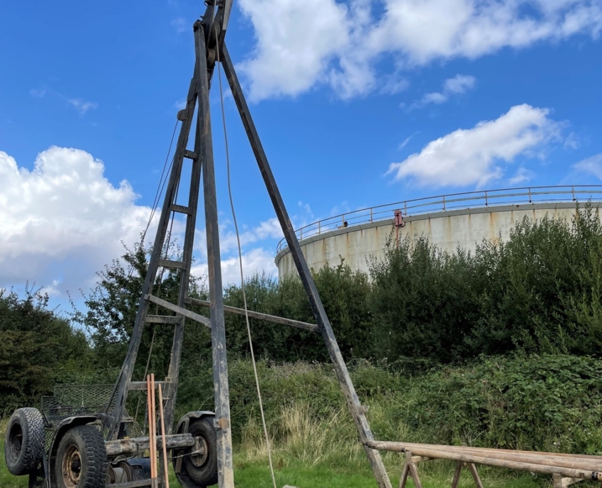
- Cable Percussive Boreholes
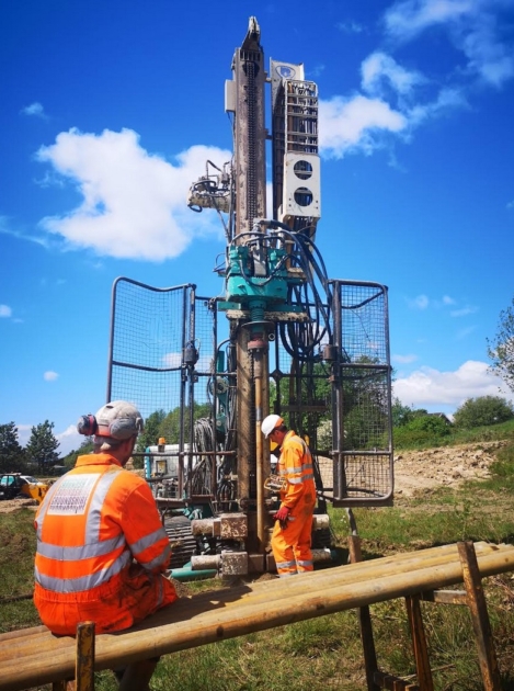
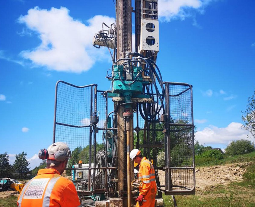
- Window Sample Drilling
- Deep Window Sample Borehole
- Rock Coring
- Rotary Boreholes
- Rotary Core Drilling
- Dynamic Probing
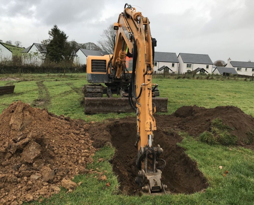
- Trial Pits
- Trenches
- Windowless Sampling Rig
- Soakaway Testing
- Modular windowless sampling drilling rig
- Plate bearing testing
- California bearing ratio (CBR) testing
Step 3 – Post Site Investigations
Once the preliminary site investigations have been completed the results are analysed. If further site investigations are required these can be completed by our multi-disciplined team. These could include:
- Environmental Monitoring
- Soil Testing
- Geotechnical Monitoring
- Slope Stability Assessment
- Radon Monitoring
- Remediation Designs
- Gas protection measures.
Step 4 – Site Investigation Report
An interpretive report will then be compiled from all the information and data gathered from the ground investigations, testing, monitoring for the site.
Our Earth Environmental & Geotechnical consultants can discuss the details of the report and provide further services as required
Site Investigations and Remediation Strategy.
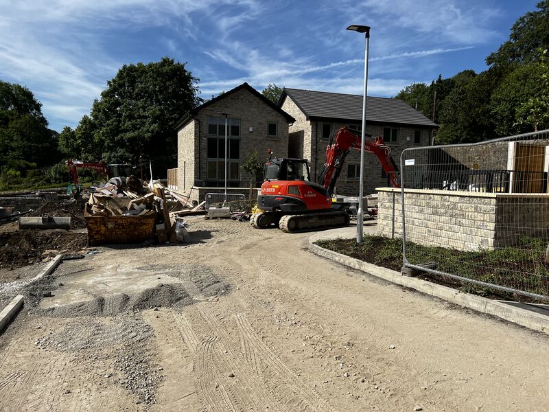
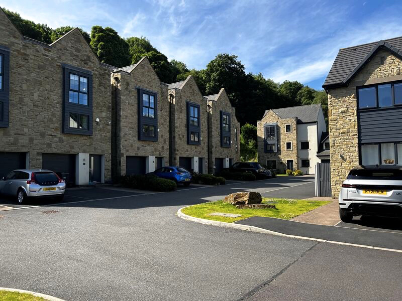
Last week Adam Czarnecki, Managing Director at Earth Environmental & Geotechnical, was back visiting Victoria Meadows. This is our third project in Ripponden, West Yorkshire, following Site Investigations and Remediation Strategy services.
“It’s always enjoyable to see projects that we were involved with progressing, and great to see a former area of tipping on a derelict site transformed to provide quality new housing. Very proud to see the development progressing so well despite the problem with trade supplies. Great to see the Remediation Strategy being implemented”
Earth Environmental & Geotechnical Ltd. conducted site investigations and developed the remediation strategy to address the challenges of developing on this former derelict site. The site investigations, risk assessments, and resultant remediation strategy, supported the successful planning application to develop 24, three, and four bedroom properties, some with stunning views over the River Ryburn.
The project included a Construction Environmental Management Plan (CEMP) which provided a site-specific statement on how the effects of construction on the surrounding environment and community will be mitigated or minimised. The plan also provided specific detail on the control of noise, dust, and odour based on the relevant guidance documents.
Earth Environmental & Geotechnical Ltd was also commissioned to provide a Remediation Method Statement (RMS) for the site at Halifax Road, Ripponden.
The Background
The development site lies northeast of Ripponden, a conservation village in the beautiful Ryburn Valley. Nearby is Rishworth Moor, an area of outstanding natural beauty, home to a wealth of wildlife and a series of ancient round barrow burial sites, known as the ‘Cat Stones. With great connections to both Leeds and Manchester via the M62, and Sowerby Bridge train station less than 2 miles, the site’s in a great location.
The proposed residential development of twenty-four plots, consisting of a mixture of two and three storey dwellings, combined with a split-level design for the residential units, in sympathy with the site’s topography.
The initial phase 1 desk study in 2016 had identified several areas requiring further site investigations and risk assessments including:
- Geotechnical hazards
- Differential settlement issues for foundation and pavement design.
- Potentially deep piled foundations.
- Potential for localised landslips along slope, which may require ground improvement
- Clay heave affecting foundations
- Excavations affecting local structures’ stability.
- Extent of wall foundations affecting foundations
- FRA- The site was within an Environmental Agency flood plain, and a Flood Risk Assessment was required.
- Gas monitoring visits and targeted investigation and survey of potential contamination
- Japanese knotweed and Himalayan balsam required an ecology survey
An appropriate ground investigation strategy was required including Window Sampler Boreholes & Trial Pits to retrieve geotechnical data of the ground conditions.
Earth Environmental & Geotechnical Ltd were requested to provide a summary of land stability on the proposed development area having previously completing a Phase 2 Site Investigation Report for the site in 2018.
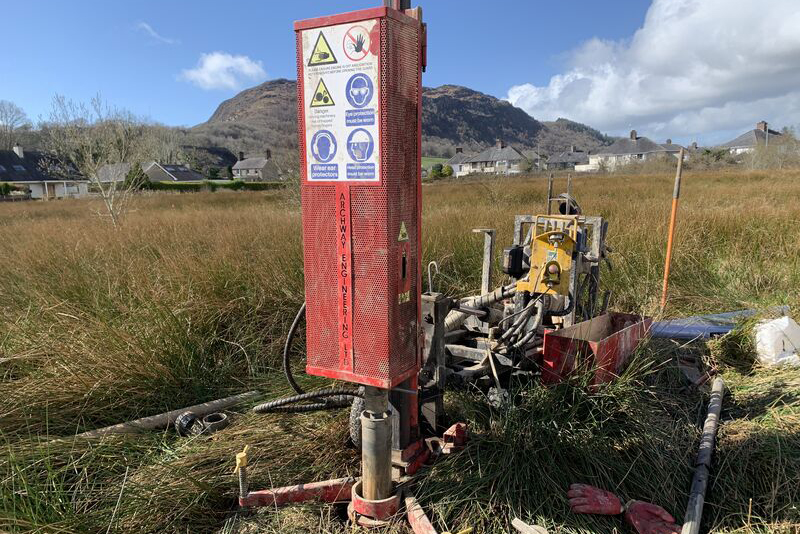
Geological records suggest that the majority of the site is underlain by Head deposits consisting of clay, silt and sand. Previously a cable and percussive drilling rig had been used to drill a number of boreholes on the site, which revealed variable ground conditions with a shallow rockhead, the East Carlton Grit of the Millstone Grit Group.
The previous phase 1 desk study with site walkovers suggested that to maintain the stability of the existing retaining wall, strict controls over excavations and earthworks would be required during construction, with the relevant risk assessment and method statements set in place during the detailed earthworks, pavement and structural design.
Furthermore, some form of monitoring regime of the retaining wall would be required during construction works to ensure stability of the highway.
The greenfield site being developed for the residential development was situated on a poorly drained sloping site that lies adjacent to the River Ryburn. The site investigations and land stability assessment recommended that due to the sloping nature of the site, plots should be constructed at different finished levels and incorporate retaining walls and comprehensive surface water drainage system. Land gradients were therefore designed to be reduced with an overall improvement in land stability.
Site Investigations and Remediation Strategy.
The site investigation comprised the drilling of five windowless sample boreholes (WS1 to WS5) to a maximum depth of 4.0m bgl and the excavation of eight machine excavated trial pits (TP1-TP8) to a maximum depth of 3.2m bgl to allow for the collection of environmental and geotechnical samples and for the assessment of ground conditions at the site.
Eighteen Dynamic Cone Penetrometer tests (DCP1 to DCP18) were also undertaken in areas of proposed hardstanding, although no soil samples were recovered as part of this exercise.
Monitoring wells were installed in each of the windowless sample boreholes (WS1 to WS5) to obtain information on groundwater levels, ground water contamination, ground gas concentrations and flow rates.
Soil chemical testing was also completed and ground water samples recovered and the results considered in the remediation strategy. Ground gas monitoring was completed with reference to NHBC “Guidance on evaluation of development proposals on sites where methane and carbon dioxide are present”, March 2007 and also methodology detailed in CIRIA C665 “Assessing risks posed by hazardous ground gases to buildings”.


