Updated Radon Map for Great Britain
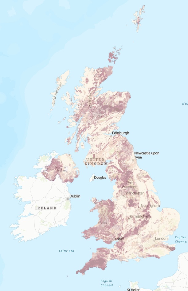
The UK Health Security Agency (UKHSA) and the British Geological Survey (BGS) have published an updated radon potential map for Great Britain.
Whilst every building contains some level of radon the levels are usually low, so the risk to health is small. However, in some parts of the country e.g. Bristol, areas of Wales, Cumbria, and parts of the peak District to name a few, buildings and grounds may have higher levels of radon and there may be a need for radon monitoring in specific areas.
In December 2022 the UK Health Security Agency (UKHSA) and the British Geological Survey (BGS) published an updated radon potential map for Great Britain, the first update in 10 years.
The risk of developing lung cancer from exposure to radon remains low and the vast majority of buildings remain outside Affected Areas.
Individuals and employers are encouraged to check the map to see if a radon test is advised in homes and workplaces in their area.
The updated radon potential map, produced by UKHSA and BGS, is the first in over 10 years and provides an authoritative analysis of the likelihood of a building being in a radon Affected Area (an area with higher radon potential).
Radon is a colourless and odourless gas that is attributed to 1,100 lung cancer deaths per year in the United Kingdom. The risk is highest among smokers and ex-smokers.
For most people, the risk of developing lung cancer from exposure to radon remains low and levels of radon have not increased across the UK. However, UKHSA advises you to test your home if you live or work in an Affected Area. There are several methods of reducing high radon levels in buildings.
The latest update to the map, available to view at UKradon.org, is the product of years of new analysis and research, combining the latest geological mapping with one of the largest databases of in-home measurements ever compiled.
While the vast majority of buildings remain outside radon Affected Areas, this new map has refined our knowledge of areas where high radon levels are more likely to occur. The overall number of buildings with high radon levels remains the same.
The radon map allows local councils, national and regional governments, social and private landlords, private homeowners, and employers to assess the radon risk in their properties. It is also used in building regulations to inform where radon preventative measures should be incorporated in new buildings.
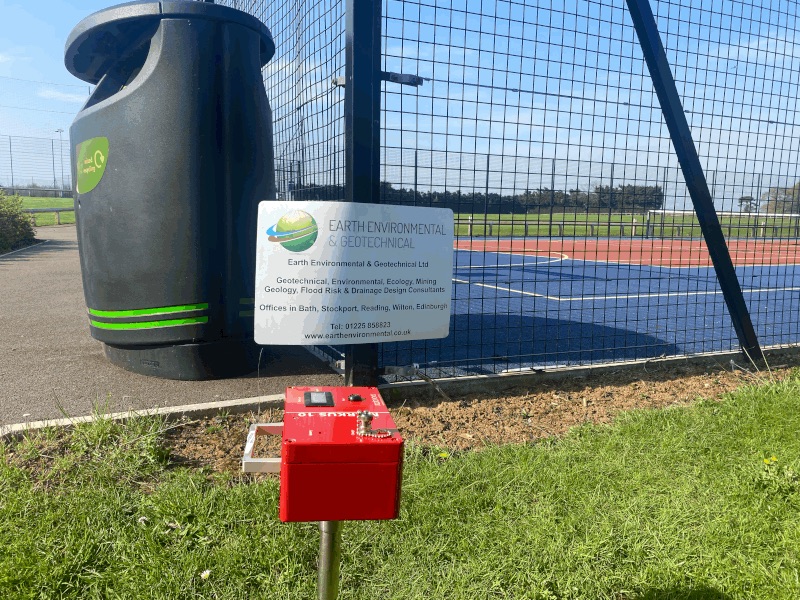
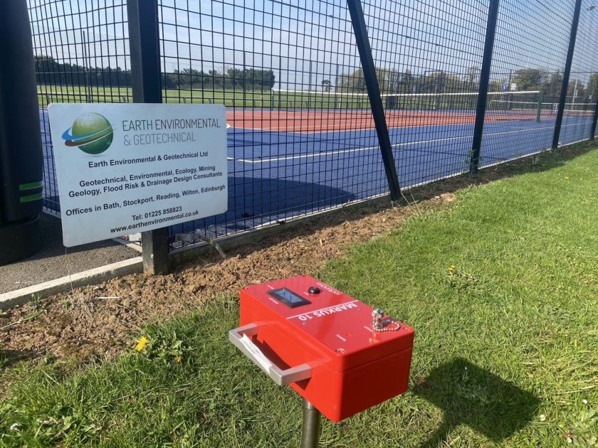
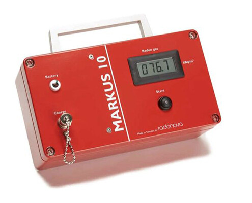
Radon Monitoring and detection is an essential assessment required in risk areas throughout the UK. Earth Environmental & Geotechnical have invested in a MARKUS 10 instrument that allows for in-situ measurement of radon gas in soils.
Over the past 12 months, the Health & Safety Executive (HSE) has been particularly active in assessing compliance with radon risk assessments.
Under the Management of Health and Safety at Work Regulations 1999, all employers must assess health and safety risks, and this includes radon. For both landlords and employers, if the property is located within a designated radon ‘affected area’, radon testing must be carried out to measure the hazard and complete the risk assessment.
Dr Maria Dugdale, Chair of UK Radon Association said, “Increasing awareness of radon is vital if the number of deaths from radon-related lung cancer is to be reduced. These deaths are largely avoidable, but many homeowners, landlords and employers still aren’t aware of the need to test their properties. We are also targeting schools as this is a sector that the Health & Safety Executive (HSE) have been particularly active in assessing compliance in over the past 12 months.”
But How Do You Know if Your Building, Land, or Grounds Has Higher Levels of Radon?
If you have identified that your proerty or land is in a high risk area how do you identify the specific radon risk?
Earth Environmental & Geotechnical work with Local Authorities, Property developers, housing associations, schools, and employers to help identify the radon risk for your property or building development. We provide a comprehensive range of Radon Survey, Detection, and Monitoring Services.
Including using MARKUS 10 instruments that allows for in-situ measurement of radon gas in soils. The Markus 10 can provide a clear understanding of the radon levels in the soil of your School site and can quickly allow for an informed decision on whether the site requires radon mitigation measures.
For further information on radon monitoring and detection for buildings and development land please contact Earth Environmental & Geotechnical now
Updated Radon Map for Great Britain
Radon Monitoring
Earth Environmental & Geotechnical: MARKUS 10 instrument Allows for in-situ Measurement of Radon Gas in Soils.
If you are planning any development for a new residential or commercial development the Markus 10 can provide a clear understanding of the radon levels in the soil of your development site and can quickly allow for an informed decision whether the development requires radon mitigation measures.
The Radon Atlas shows the bands of radon risk in each 1 kilometre grid square of England and Wales. This is only a coarse gridded assessment of radon potential, defined as the estimated percentage of homes in an area above the radon action Level. The risk is indicative, not definitive, and the atlas shows the whole 1km grid square according to the highest radon potential.
The advantage of the Markus 10 is that it provides the actual radon measurements specific to the soil of the development site. The equipment can be used to map the whole site to provide a clear and accurate understanding of the actual radon levels and then informed decisions can be made if radon mitigation is required and how extensive they need to be.
The Markus 10 will measure the radon content within 14 minutes after starting the measurement and only 18 minutes waiting time is required between each measurement.
The instruments are particularly good for pre planning ground investigation work and can be used before designs or construction works start on new developments or brownfield land development. In-situ testing allows for an enhanced assessment of radon potential of shallow soils rather than sole reliance on the Radon Atlas.
Using the Markus 10 when assessing development land could mean that a site that may not look viable according to the Radon Atlas actually is or that any radon issues are captured at the pre planning phase so development designs can be adapted before designs are finalised for planning applications.


