Why are Mining Risk Assessments and Coal Mining Risk Assessments Important?
Historic Mining Puts 170,000 Bristol Properties at Risk of Subsidence.
Recent reports have highlighted just how extensive historical mining activities can be. In Bristol new research alerts homeowners of the potential hazards associated with historic mine shafts in Bristol city centre. This case study identified over 170,000 properties in Bristol which could be at risk of ground movement from historical mining activity.
Redcliffe Caves are a series of man-made tunnels beneath the Redcliffe area of Bristol. Hidden behind a small door in the banks of the harbour is an access to these tunnels, a popular tourist attraction. Despite the name, the Redcliffe Caves are actually mines, and the entire system was carved by hand. The Triassic red sandstone was first dug in the Middle Ages to provide sand for glass making and pottery production.
Further excavation took place from the 17th to early 19th centuries and was used for the storage of trade goods. Several buildings in the area have, or did have access to the caves from their cellars, including the Ostrich pub where part of a wall has been demolished to show part of one of the caves.
The full extent of the tunnels has not been explored as part of the site was split by a rail tunnel. Only a fraction of the mined tunnels has actually been mapped out, as during World War II a large bomb detonated in Redcliffe, causing a massive cave-in that permanently blocked what is thought to be the majority of the complex.
But the latest research highlights that the underground systems are extensive, with the potential to impact over 170,000 properties. There are currently 82 reported ground collapses in the region, and with 243 mines, pits and quarries recorded in the area, this number is likely to increase.
What Should Property Developers Do to Understand the Risk of Subsidence from Mining?
At Earth Environmental & Geotechnical we offer a wide range of services to help property developers, residential owners and commercial developers understand the land that they are planning to develop or currently own.
The impact of historic mining activity or indeed current mining activity needs to be assessed before development designs and planning applications are submitted. If you are buying a property or land, your conveyancing solicitor may advice you to obtain a Mining Search in addition to the Local Authority Searches. Some lenders may refuse mortgages for properties near historic mining areas. So it is essential that, as a homebuyer, land buyer or property developer, you are aware of the risks posed by former mining activity to a property and what steps can be taken to mitigate the risks.
Types of Risk Assessments Available
At Earth Environmental & Geotechnical we provide a full range of Risk Assessments depending on the specifics of your development land.
The preliminary risk assessment would be a Phase 1 Desk Study – A Phase 1 Desk Study is an interpretive report for a development site, often required for planning application approval. The Phase 1 Desk Study would identify if further Mining Searches or Site Investigations are required.
Ideally, a Desk Study should also be accompanied by a walk over a survey conducted by an experienced practitioner. By compiling available information in relation to a site’s environmental, geological, hydrogeological, hydrological and mining setting a cost-effective and focussed site investigation will be developed. A Phase 1 Desk Study should always precede any ground investigation.
If your property or development site is in an area of coal mining activity then a Coal Mining Risk Assessment CMRA will be required. This can be completed in conjunction with the Phase 1 Desk Study.
Head Office: North West
Our Head office is in Stockport, just outside of Manchester
Stockport is an unbeatable location. Under two hours from London and only 10 minutes from Manchester city centre by train, the town is also close to Manchester International Airport, and directly off the M60 Motorway making it a prime location for international business. So we are perfectly placed to offer geotechnical, mining, geological and environmental services to clients across North West England.
HEAD OFFICE
Houldsworth Mill Business & Arts Centre,
Houldsworth Street,
Stockport,
SK5 6DA
Email: headoffice@earthenvironmental.co.uk
Tel: 0161 975 6088
Scotland Office
Our Edinburgh office benefits from expert knowledge and a keen understanding of the area it serves, including the region that powered the development of Scotland’s industrial past.
We offer geotechnical, mining, geological and environmental services to your clients across Scotland and the north of England. The region carries its own challenges. From Prestwick across to St Andrews, through Glasgow and Edinburgh, runs an extensive coal resource that fuelled the historical development of the region. The area also contains a high concentration of Development High Risk Areas, an extensive catalogue of abandoned mines, numerous mine entries, coal outcrops, past (and some current) surface mining and more. All of which creates a challenging building and development environment, demanding thorough research and reporting. Coal mining activity in Scotland is almost exclusive to this area.
As with other areas of the UK, radon in Scotland is widespread, with highest radon potential, a maximum of between 10 to 30%, found across an area from the Cairngorms to Deeside; plus a pocket of radon potential greater than 30% around Helmsdale on the Moray Firth.
In terms of mineral resources, the varied geology of the region of Clackmannanshire, Fife and Falkirk, the Lothians and Edinburtgh, Ayrshire, Dunbartonshire, Renfrewshire, Lanarkshire and Glasgow offers various types of sand and gravel, limestone, building stone, aggregates, a variety of clays, hydrocarbons, oil-shale and more.
Get in touch to discover more about our wide range of land, environmental and geotechnical services tailored to the Scottish region.
SCOTLAND
Hudson House,
8 Albany Street,
Edinburgh,
EH1 3QB
Email: scotland@earthenvironmental.co.uk
Tel: 0131 564 1789
www. Earth Environmental – Scotland
Why are Mining Risk Assessments and Coal Mining Risk Assessments Important?
If you are planning a new development or extending a property it is essential to have a thorough understanding of what you are building on. So why are Mining Risk Assessments and Coal Mining Risk Assessments Important?
With over 150,000 abandoned mines across the UK and more than 130,00 properties within just 20 metres of a mineshaft, historic mining activity still impacts current developments, so having a detailed risk assessment could be essential for your site planning proposals.
Almost one-third of all residential properties in Wales and England are at risk of being affected by past mining activity. Reports estimate that 33% of homes are built within 250m of land that may have been used for coal mining and quarrying of sand, clay, and gravel pits.
Mine-workings can extend for long distances underground and can even be found under residential and commercial properties. The UK has a long history of mining, and for over 4,000 years there has been mining activity. There may no longer be signs left in the area of previous mining activity, but below the surface may be hidden issues that could cause a significant impact on your property development.
Also, there are around 2,000 mines and quarries across the UK producing a range of materials including:
- Lithium mining in Cornwall
- Tin and in Cornwall and Devon
- Gold Mining in the Scottish Highlands, North Wales, and throughout England
- Polyhalite in Yorkshire
- Coal in Cumbria
- Barite in Perthshire
- Fluorspar and Lead in the Peak District in Derbyshire
Why are Mining Risk Assessments and Coal Mining Risk Assessments Important?
The data on Bristol highlights why it is essential to understand what you are building on when planning your property development or extension. Throughout the UK there are areas of extensive historic mining activity to extract a wide range of metals, minerals, coal mining, quarrying for stone, all of which can impact your development land.
One of the biggest impacts mining can have on a property is subsidence, which is the downward movement or “sinking” of a property. Subsidence affects all areas of the UK and can have a major effect on the topography of the land surface.
Properties can be affected by natural subsidence and non-natural subsidence. Natural subsidence is a result of natural geographical hazards. Non-natural ground subsidence is a result of human activities e.g.mining and quarrying. The removal of materials such as coal, sandstone, tin, and other metals from an underground mine can result in roof materials to cave in, leading to subsidence on the surface.
What is a Coal Mining Risk Assessment?
The aim of a CMRA is to identify any coal mining legacy risks and set out a proposed mitigation strategy to demonstrate to the Local Planning Authority that the site can be made safe and stable for the proposed development. In some cases it may be possible to ensure that the development layout avoids recorded high risk features. https://www.gov.uk/guidance/planning-applications-coal-mining-risk-assessments
To find out more about Earth Environmental & Geotechnical’s Coal Mining Risk Assessments please click here
What is a Mining Search?
Mining searches assess the risk posed from historic mining activity. These shafts and tunnels could potentially cave in if not properly dealt with, causing subsidence and damage to the buildings above them.
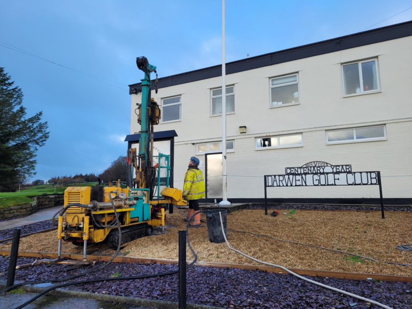
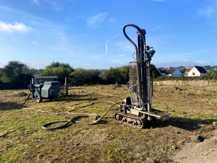
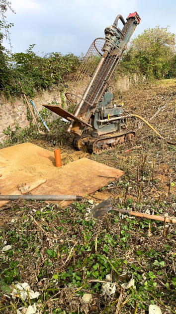
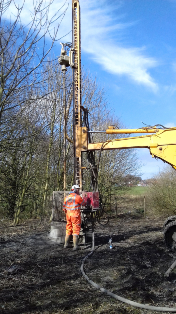
So it’s important that a full risk assessment takes place to minimise the need for future financial investment, as well as to protect occupants. The latest technological advancements can also be utilised to assist in mining investigations and interpretation. For example, drones are commonly being used to investigate mine workings and property areas, providing added reassurance and evidence which can assist in making remediation decisions. Where significant mining features are identified, ground investigation is recommended to clarify any associated risks.
South West Office
If you are looking at land or a residential or commercial property in the South-West of England, contact our South West Office.
Natural challenges presented by the region include high radon levels, particularly in the moorland regions of Dartmoor, Exmoor, Blackmoor Bodmin Moor and the Wendron Moors, as well as spikes from Barnstaple, up through Bristol and Gloucester towards the Midlands. There are also development high risk areas around Bristol, Midsomer Norton, and east of Bideford, due to historical coal workings.
Further west – Devon and Cornwall have historically exploited natural mineral resources, for example through clay and tin mining, and these can also present their problems for existing buildings, and potential developments.
With our local knowledge and the wide range of resources and expertise available to us, Earth Environmental and Geotechnical here in the South West is ideally placed to deliver environmental and geotechnical services matched to regional needs. Depending on your location Metalliferous Mining Search may also be advisable. This search will reveal if the property resides in an area of mining activity be that past, current or proposed. It will also note the location and distance to the nearest recorded and suspected mines. The report typically includes tin, copper, lead, silver, iron and zinc mining.
The search will also assess whether mining in the area could have caused land contamination.
SOUTH WEST
Studio 3,
Tollbridge Studios,
Toll Bridge Road,
Bath,
BA1 7DE
Email: southwest@earthenvironmental.co.uk
Tel: 01225 858823
www: Earth Environmental – South West
North East Office
Our North East office benefits from expert knowledge and a keen understanding of the area and its bespoke issues. Including the regions’ historic industrial past, and the coal and ironstone mining legacy which powered it..
We offer geotechnical, mining, geological and environmental services to a range of clients across the North East, covering regions including Tyne & Wear, Durham, Teesside, Northumberland and North Yorkshire. The region carries its own challenges such as the regeneration of its urban former industrial and chemical centres. The extensive coal resource that fuelled these past industries affects much of the northern half of the region, which has a high concentration of coal authority development high risk areas, an extensive catalogue of abandoned mines, numerous mine entries, coal outcrops, past (and some current) surface mining and more. These create a significant challenge to development, demanding thorough research and reporting, with local knowledge being absolutely vital in these situations.
The southern part of the region does not escape complex issues which include the Ironstone mining legacy of North Yorkshire and Teesside along with the associated steel and chemical industry legacy, as well as gypsum dissolution concerns in areas such as Ripon and Darlington.
NORTH EAST
The Wilton Centre,
Redcar,
TS10 4RF
Email: northeast@earthenvironmental.co.uk
Tel: 01642 438125
www. Earth Environmental – North East
South Office
The Reading office of Earth Environmental and Geotechnical Ltd., covers an area across the south and south east that is demanding in its varied geology, and because it’s probably the busiest region on the UK in terms of building and development.
We cover a large area, from Oxfordshire to Suffolk, and from Buckinghamshire to West Sussex and Kent. The environmental challenges presented by the geology in the south of England include the Kent Coalfield, a large surface coal resource area stretching eastwards from Canterbury into the Channel. This area contains abandoned surface mines and small, isolated spots marked as Development High Risk Areas. Radon is a more widespread problem, particularly south-east of Canterbury, East of Winchester, and between Chichester and Worthing, where some parts are in bands of elevated radon potential between 5 and 10%. A lower band of potential radon, between 1 and 4%, stretches across Kent, West of Canterbury, across the North Downs and up to London itself.
In terms of mineral resources, the region, particularly Kent, is renowned for high purity chalk, while a wide range of other resources include limestone, various types of sand, and brick clay. High purity chalk stretches westwards, across Surrey, as does a band of brick clay. London offers large superficial sand and gravel resources, including active sites and planning permission – particularly to the east and west. Counties such as Herts, to the north of London, also contain mineral extraction sites, both active and with valid planning permissions.
There are areas of outstanding natural beauty, and special scientific interest, across the region.
Earth Environmental and Geotechnical in the South has the knowledge, expertise and resources to provide detailed information on any location within the south and south-east of England.
SOUTH
200 Brook Drive,
Green Park,
Reading,
Berkshire,
RG2 6UB
Email: south@earthenvironmental.co.uk
Tel: 01189 253229
www. Earth Environmental – South


